


Charles Lindbergh was lost. It was December, 1927, and Lindbergh—recently returned from his solo flight across the Atlantic—was again flying solo, this time from Washington, D.C. to Mexico City on diplomatic goodwill mission, with a bit of unnecessary bravado for good measure.
He had the navigation aids available to pilots at the time: simple road maps. Compared to the Atlantic, though, this flight should have been a snap.
A storm over northern Mexico had other plans. When Lindbergh emerged from the clouds, nothing seemed to line up with the maps he had with him. He spotted train tracks and followed them, flying low over stations, buzzing them as close as he could to spot names on the station signs. Finally, he found a sign he could read: “Caballeros.” There was no town called Caballeros on his maps. As he learned later, he had found a sign pointing to the men’s bathroom.
Lindbergh’s trouble was typical for pilots of the day. Apart from the 2,680-mile long transcontinental route linking New York with San Francisco created for the US Postal service airmail flights, there were few maps or aerial navigation tools for pilots of the day. There were air route maps emerging in the ‘20s, but they weren’t for pilots yet: they were for the rest of us.
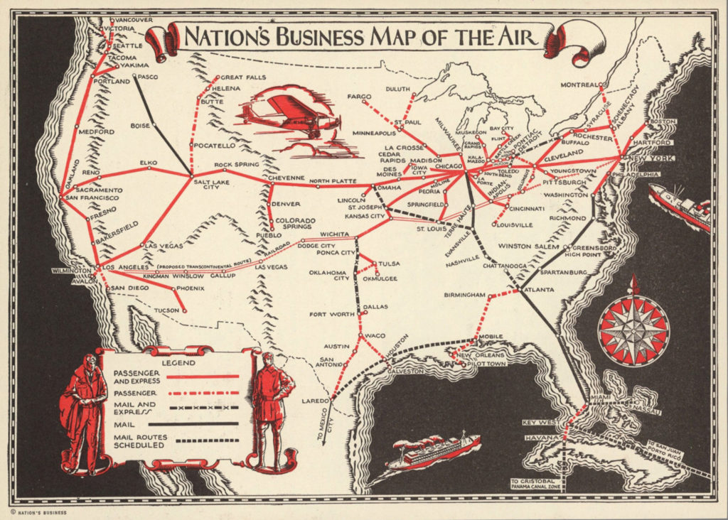
Nation’s Business Map of the Air, transcontinental passenger and mail routes, 1929. David Rumsey Map Collection.If you’ve ever spent too much time on a long flight staring at an in-flight magazine, tracing the arcing lines of a route map, dreaming of the destinations you could potentially fly to, you know one purpose of route maps: marketing.
“In the early years they weren’t just marketing a particular airline and where it flew. Airlines were marketing the very technology of aviation itself, at a time when consumers were still very skeptical of air travel as a means of transportation,” Jenifer Van Vleck, curator at the Smithsonian National Air and Space Museum and author of the book Empire of the Air: Aviation and the American Ascendancy, told me.
From the beginning, air travel was largely only accessible to the wealthy. Airlines went to great lengths to cultivate a feeling of glamour and prestige to appeal to their monied audience. That came through in their use of design, from the planes themselves to uniforms, and, of course, route maps.
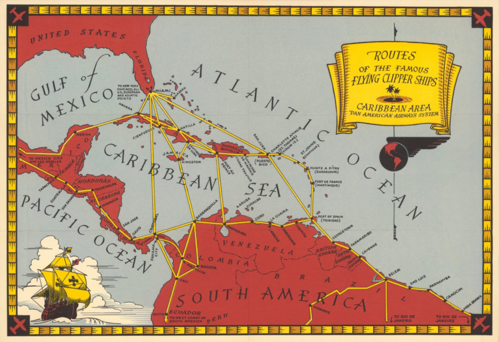
“Less time on the way…More time for work or play” Pan Am’s routes in the Caribbean, Central and South America, 1930. David Rumsey Map Collection.Beyond simply showing where passengers could fly, route maps made travel look easy, appealing, and luxurious. Geographic barriers? Long distances? No problem. Sit back and enjoy this complimentary beverage while fantasizing about your next journey.
Geographic barriers like mountain ranges and rivers were so inconsequential from the air that routes maps started leaving them out entirely. Some omitted borders. Many gave up any pretense of accurate geographic representation of the world. Hawaii? Why not plop it right next to California? Look how close it is!
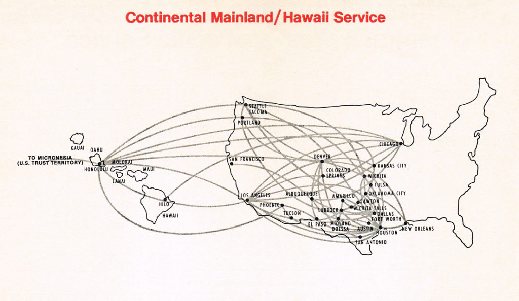
Hawaii: so close, yet so not even close to proportional. Continental, 1969.
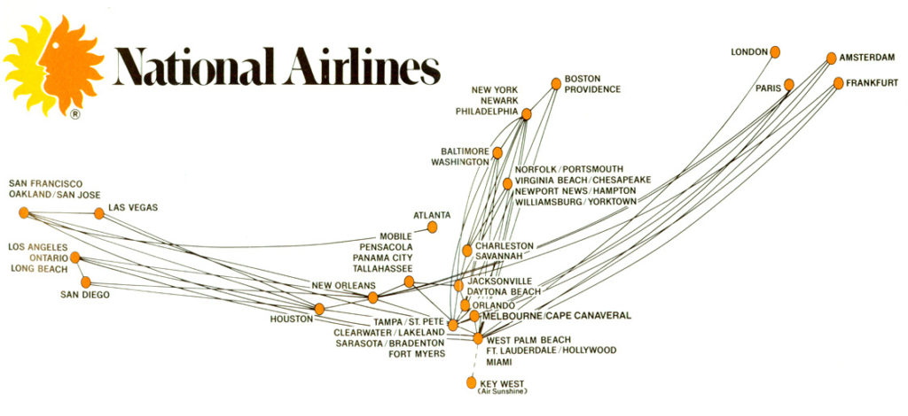
National Airlines, 1978. Who needs borders? Or land?Van Vleck sees an unintended side-effect in these simplified maps: cities became the only meaningful units of geography.“You see that in the ‘fly-over country’ language, that what really matters in the United States are the cities on the coasts. Everything in between is just landscape that can be dismissed,” she says.While airline route maps followed aesthetic trends, largely tracking the advertising and subway map designs of their day, they also reflected political trends.
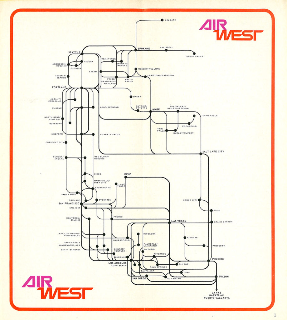
Air West system map, 1968. As easy as riding the subway, just in the sky.
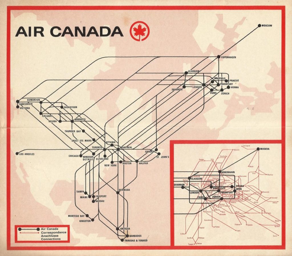
Air Canada, 1972, also enjoying the red border and subway-style route lines.“You can see this in Pan Am’s route maps: its early maps depicted really a western hemisphere world. In the ‘20s and ‘30s, U.S. power was primarily located in the western hemisphere,” Van Vleck says. “Then beginning in WWII, the U.S. really begins to project power on a global scale, and you can see that same progression in Pan Am’s route maps beginning in the mid ‘30s and especially during and after the war.”Those route maps were part of a broader shift in the way Americans saw their place in the world. The WWII maps by geographer Richard Edes Harrison in Fortune Magazine depicted the globe from an orientation that Americans hadn’t seen before, one that showed that the United States wasn’t as safely isolated as we had thought, particularly in an era when war came from the air.
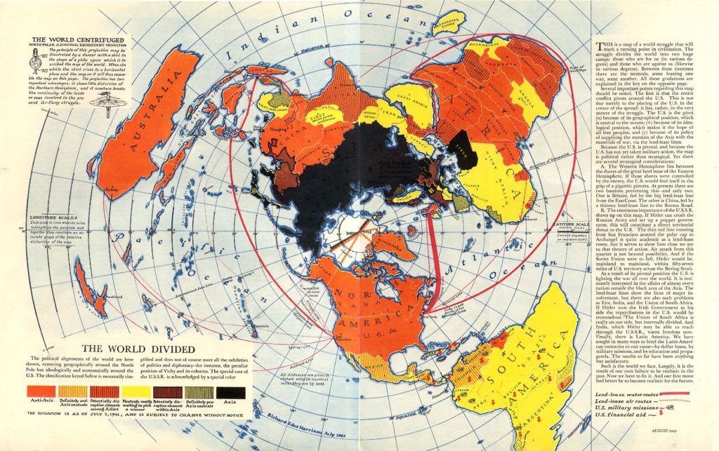
“The World Divided” by Richard Edes Harrison, Fortune Magazine, 1941“Cartographers control how people understand all the places they’ve never been. If it’s not on the map, it doesn’t exist in the person’s imagination,” cartographer Daniel Huffman, who runs the site somethingaboutmaps.com, told me. “I can show you a map of Iceland, and if you’ve never been there, most of what you think about Iceland is what I chose to put on the map. Mapping is mostly about what we choose to leave off.”
Huffman, who has designed and updated route maps for airlines, sees modern route maps mostly as corporate symbols and art pieces designed to make an airline look impressive. Often, the maps convey more about the company than just the routes they fly.
Take the current United Airlines map, crisscrossed by so many routes that most of America’s land is lost below the dense thatch of lines.
“Maybe the message is that United goes everywhere, so much so that the map can’t even contain it. Maybe that’s the perspective that some companies want: to overwhelm the customer with how impressive they are that normal modes of information conveyance just will not work for us,” Huffman says.
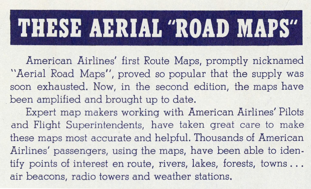
The popularity of American Airlines’ first route maps. The term “aerial road maps” proved less popular. 1939. David Rumsey Map Collection.Whichever way your aesthetic tastes fly, airline route maps are magnetic to travelers. (In an informal online poll before this article was written, 56% of respondents voted for route maps as the best section of an in-flight magazine, while 25% chose puzzles, and 19% opted for feature stories).What makes route maps so popular?
“Aside from Google Maps, we don’t really encounter maps in everyday life so much anymore. That moment of sitting down and pulling out the in-flight magazine and seeing all the places that airline flies to, it’s one of those little moments in which a broader historical process becomes literally visible,” Van Vleck says.Or maybe it’s that a Hawaiian beach, a New Orleans jazz club, an Alaskan glacier—places that felt impossibly distant yesterday—suddenly seem just a few easy inches away.
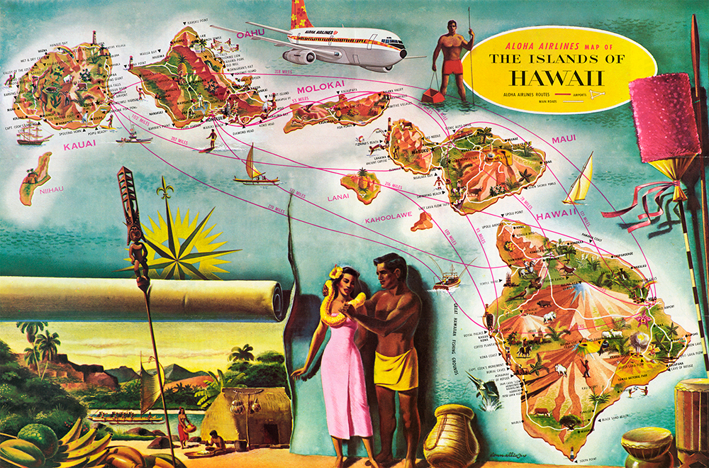
Aloha Airlines route map, c. 1960. A version of this map was used as wall art in the old Aloha Airlines terminal in Honolulu.
All Rights Reserved for Andy Murdock
